Search results
Jump to navigation
Jump to search
File:Orthographic projection above St Helena.png ...le. And I would like to express my gratitude to those who made that great tool available.(488 × 487 (9 KB)) - 20:59, 18 April 2022
File:Orthographic projection centred over Tashkent, Uzbekistan.png ...eated using this [http://www.aquarius.geomar.de/omc/ online map creation ] tool. ...eated using this [http://www.aquarius.geomar.de/omc/ online map creation ] tool.(488 × 487 (20 KB)) - 14:38, 14 May 2023
File:Orthographic projection centered over the Baffinland Iron Mine.png |notes = I created this map with an online map-making tool -- sadly no longer available. ...under an open license. To honor the original workers who provided a fine tool I choose to put my maps in the public domain(488 × 487 (21 KB)) - 20:37, 19 April 2022
File:Orthographic projection centred over Jordan.png ...rated using this [http://www.aquarius.geomar.de/omc/ online map creation ] tool.(488 × 487 (20 KB)) - 23:48, 22 April 2022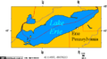
File:Erie PA on Lake Erie 1.png ...eated using this [http://www.aquarius.geomar.de/omc/ online map creation ] tool.(514 × 283 (9 KB)) - 00:08, 23 April 2022
File:Orthographic projection centred over Prince Rupert.png ...eated using this [http://www.aquarius.geomar.de/omc/ online map creation ] tool.(488 × 487 (21 KB)) - 21:41, 19 April 2022
File:Orthographic projection centred over Astana Kazakhstan.png ...eated using this [http://www.aquarius.geomar.de/omc/ online map creation ] tool.(488 × 487 (20 KB)) - 23:47, 22 April 2022
File:Orthographic projection centred over Bishkek Kyrgyzstan.png ...eated using this [http://www.aquarius.geomar.de/omc/ online map creation ] tool.(488 × 487 (20 KB)) - 23:46, 22 April 2022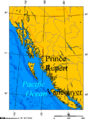
File:BC Coast.png ...eated using this [http://www.aquarius.geomar.de/omc/ online map creation ] tool.(514 × 696 (40 KB)) - 23:32, 22 April 2022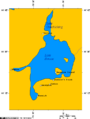
File:Lake Simcoe Ontario.png ...= This map was created using [http://www.aquarius.ifm-geomar.de/omc/ this tool].(534 × 708 (10 KB)) - 17:21, 29 April 2022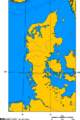
File:Jutland peninsula.png ...= This map was created using [http://www.aquarius.ifm-geomar.de/omc/ this tool].(510 × 768 (112 KB)) - 17:46, 29 April 2022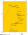
File:Neckar river watershed.png ...= This map was created using [http://www.aquarius.ifm-geomar.de/omc/ this tool].(514 × 637 (14 KB)) - 17:41, 29 April 2022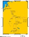
File:Rhine river.PNG ...= This map was created using [http://www.aquarius.ifm-geomar.de/omc/ this tool].(514 × 642 (20 KB)) - 17:40, 29 April 2022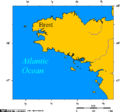
File:Brittany - France.png ...= This map was created using [http://www.aquarius.ifm-geomar.de/omc/ this tool].(514 × 480 (11 KB)) - 17:50, 29 April 2022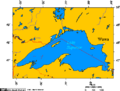
File:Wawa Ontario.png ...= This map was created using [http://www.aquarius.ifm-geomar.de/omc/ this tool].(514 × 389 (12 KB)) - 16:51, 29 April 2022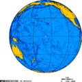
File:Orthographic projection over Jarvis Island.png ...= This map was created using [http://www.aquarius.ifm-geomar.de/omc/ this tool].(488 × 487 (19 KB)) - 09:06, 29 April 2022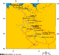
File:Elbe watershed.png ...= This map was created using [http://www.aquarius.ifm-geomar.de/omc/ this tool].(514 × 484 (21 KB)) - 17:47, 29 April 2022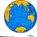
File:Indian Ocean.png ...= This map was created using [http://www.aquarius.ifm-geomar.de/omc/ this tool].(488 × 487 (22 KB)) - 18:04, 29 April 2022
File:Yenisei basin 7.png ...= This map was created using [http://www.aquarius.ifm-geomar.de/omc/ this tool].(514 × 699 (28 KB)) - 17:34, 29 April 2022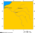
File:Seine river watershed.png ...= This map was created using [http://www.aquarius.ifm-geomar.de/omc/ this tool].(514 × 490 (11 KB)) - 17:36, 29 April 2022


