File:Ports Colbourne Dalhousie, Weller, Maitland.PNG
Jump to navigation
Jump to search

Size of this preview: 398 × 599 pixels. Other resolution: 510 × 768 pixels.
Original file (510 × 768 pixels, file size: 54 KB, MIME type: image/png)
Summary
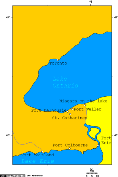
{{Image notes |Description=Map of Port Dalhousie, Port Weller, Port Colborne and Port Maitland, past and present entrances to the Welland Canal |Author=[[User:George Swan |Date=May 19, 2007 |Source=self-made |Country first published in=Canada |Copyright holder=[[User:George Swan |Notes=Made using this online map creation tool. |Other versions=}}
Licensing/Copyright status
File history
Click on a date/time to view the file as it appeared at that time.
| Date/Time | Thumbnail | Dimensions | User | Comment | |
|---|---|---|---|---|---|
| current | 19:53, 11 March 2022 | | 510 × 768 (54 KB) | Maintenance script (talk | contribs) | == Summary == Importing file |
You cannot overwrite this file.
File usage
The following 2 pages use this file: