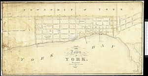
Information for "File:Old map of York, Upper Canada, 1827, Chewett, NMC16819.jpg"
Jump to navigation
Jump to search
View the protection log for this page.
Basic information
| Display title | File:Old map of York, Upper Canada, 1827, Chewett, NMC16819.jpg |
| Redirects to | File:Old map of York, Upper Canada, 1827, Chewett, NMC16819.jpg (info) |
| Default sort key | Old map of York, Upper Canada, 1827, Chewett, NMC16819.jpg |
| Page length (in bytes) | 0 |
| Namespace | File |
| Page ID | 0 |
| Page content language | en - English |
| Page content model | wikitext |
| Indexing by robots | Disallowed |
| Number of redirects to this page | 0 |
| Hash value | c255e7e3eec465124bff634994a15039a46767f7 |
| Page image |  |
Page protection
| Create | Allow all users (infinite) |
| Upload | Allow all users |