File:1920 Alta California mission trail.jpg
Jump to navigation
Jump to search
Size of this preview: 312 × 600 pixels. Other resolution: 751 × 1,444 pixels.
Original file (751 × 1,444 pixels, file size: 58 KB, MIME type: image/jpeg)
Summary
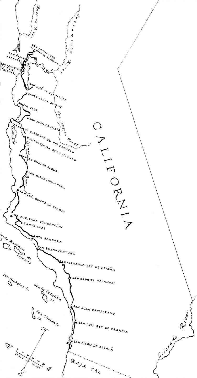
| Title / Description
|
An early map illustrating the route of "El Camino Real" and the 21 Franciscan missions. |
|---|---|
| Author(s)
|
Jones, Roger |
| Copyright holder
|
Public Domain See below for license/re-use information. |
| Source
|
California from the Conquistadores to the Legends of Laguna |
| Date created
|
1821 |
| Country of first publication
|
United States |
| Notes
|
An early map illustrating the route of "El Camino Real" in 1821, along with the 21 Franciscan missions in Alta California. The road at this time was merely a horse and mule trail. |
| Other versions
|
If there are other versions of this media on CZ, please list them here. |
| Using this image on CZ
|
Copy the code below to add this image to a Citizendium article, changing the size, alignment, and caption as necessary.
|
Image issue? Contact us via the email below.
Please send email to manager A T citizendium.org .
Licensing/Copyright status
This media, 1920 Alta California mission trail.jpg, is in the public domain
Any copyright on this work has expired.
This applies to in the European Union, the United States, Canada, and other countries with a copyright term of life of the author plus 70 years.
You may freely copy, distribute, display and perform this work, as well as make derivative and commercial works.
File history
Click on a date/time to view the file as it appeared at that time.
| Date/Time | Thumbnail | Dimensions | User | Comment | |
|---|---|---|---|---|---|
| current | 19:53, 11 March 2022 | | 751 × 1,444 (58 KB) | Maintenance script (talk | contribs) | == Summary == Importing file |
You cannot overwrite this file.
File usage
The following page uses this file: