File:1815waterloo.jpg: Difference between revisions
Jump to navigation
Jump to search

imported>Richard Jensen (Map of Waterloo 1815 source: Shepherd, William. ''Historical Atlas.'' New York: Henry Holt and Company, 1911 [http://www.lib.utexas.edu/maps/historical/shepherd_1911/shepherd-c-156.jpg]) |
(No difference)
|
Revision as of 05:58, 7 June 2007
Summary
Map of Waterloo 1815
source: Shepherd, William. Historical Atlas. New York: Henry Holt and Company, 1911
[1]
![[1]](http://www.lib.utexas.edu/maps/historical/shepherd_1911/shepherd-c-156.jpg)
Licensing/Copyright status
This media, 1815waterloo.jpg, is in the public domain
You may freely copy, distribute, display and perform this work, as well as make derivative and commercial works.
File history
Click on a date/time to view the file as it appeared at that time.
| Date/Time | Thumbnail | Dimensions | User | Comment | |
|---|---|---|---|---|---|
| current | 19:53, 11 March 2022 | 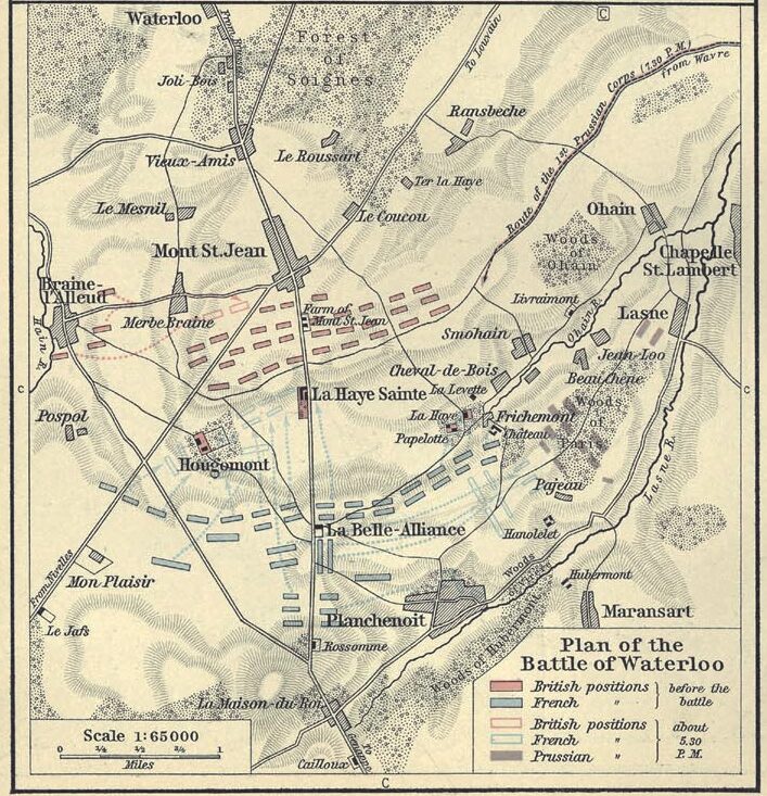 | 707 × 733 (184 KB) | Maintenance script (talk | contribs) | == Summary == Importing file |
You cannot overwrite this file.
File usage
The following page uses this file: