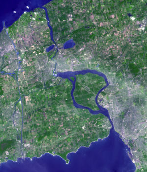
Niagara River
The Niagara River connect Lake Erie with Lake Ontario. The river forms part of the boundary between the Province of Ontario, Canada and New York State.
The river is 58 km (36.04 mi) long.
The rivers most prominent features are Niagara Falls, the 11 kilometre Niagara Gorge downstream of it, and the Niagara Whirlpool. Lake Ontario, Lake Erie, and the entire watershed of the Niagara River was covered by part of a very thick glacier that covered most of the northern half of North America.
The glacier retreated from the western end of Lake Ontario first. The eastern end, where Lake Ontario empties into the St Lawrence River, was blocked by a remaining lobe of the glacier. So glacial Lake Iroquois was larger and deeper than Lake Ontario. The lake's sourthern shoreline was the Niagara Escarpment. Water flowed from this deeper lake near present day Rochester, New York, and down the Mohawk River.
