File:Ruhr area-map.png: Difference between revisions
Jump to navigation
Jump to search
imported>George Swan ({{Image notes |Description='''Map of the Ruhr Area, Germany''' * The map shows the Ruhr Area, Germany with all cities over 50,000 Inhabitants * "drawn" by myself, wikipedia user [http://commons.wikimedia.org/wiki/User:Threedots Threedots (Daniel Ullrich)] with Adobe Photoshop 6.0 on 10th of December 2004 * Database: [http://www.ruhrgebiet.de/daten/geodatenserver.shtml official GeoData (in german)] and several maps '''Karte des Ruhrgebiets, Deutschland''' * Die Karte zeigt...) |
(No difference)
|
Revision as of 09:24, 4 June 2008
File history
Click on a date/time to view the file as it appeared at that time.
| Date/Time | Thumbnail | Dimensions | User | Comment | |
|---|---|---|---|---|---|
| current | 19:57, 11 March 2022 | 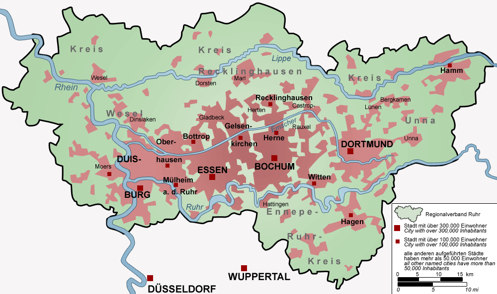 | 1,000 × 593 (115 KB) | Maintenance script (talk | contribs) | == Summary == Importing file |
You cannot overwrite this file.
File usage
The following page uses this file: