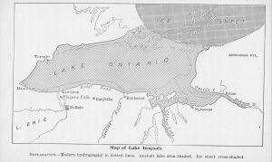
Information for "File:19th century estimate of the boundaries of Lake Iroquois.jpg"
Jump to navigation
Jump to search
View the protection log for this page.
Basic information
| Display title | File:19th century estimate of the boundaries of Lake Iroquois.jpg |
| Default sort key | 19th century estimate of the boundaries of Lake Iroquois.jpg |
| Page length (in bytes) | 305 |
| Namespace | File |
| Page ID | 380 |
| Page content language | en - English |
| Page content model | wikitext |
| Indexing by robots | Allowed |
| Number of redirects to this page | 0 |
| Hash value | e36a17236a7ea85d7cd29ea7caae853ab5ee0aef |
| Page image |  |
Page protection
| Edit | Allow all users (infinite) |
| Move | Allow all users (infinite) |
| Upload | Allow all users (infinite) |
Edit history
| Page creator | imported>George Swan |
| Date of page creation | 04:15, 23 February 2009 |
| Latest editor | George Swan (talk | contribs) |
| Date of latest edit | 20:27, 19 April 2022 |
| Total number of edits | 6 |
| Total number of distinct authors | 4 |
| Recent number of edits (within past 90 days) | 0 |
| Recent number of distinct authors | 0 |
Page properties
| Transcluded templates (7) | Templates used on this page: |