File:British Empire (populated areas).svg
Jump to navigation
Jump to search


Size of this PNG preview of this SVG file: 800 × 406 pixels. Other resolution: 2,560 × 1,300 pixels.
Original file (SVG file, nominally 2,754 × 1,398 pixels, file size: 1.49 MB)
.svg)
Summary
| Description |
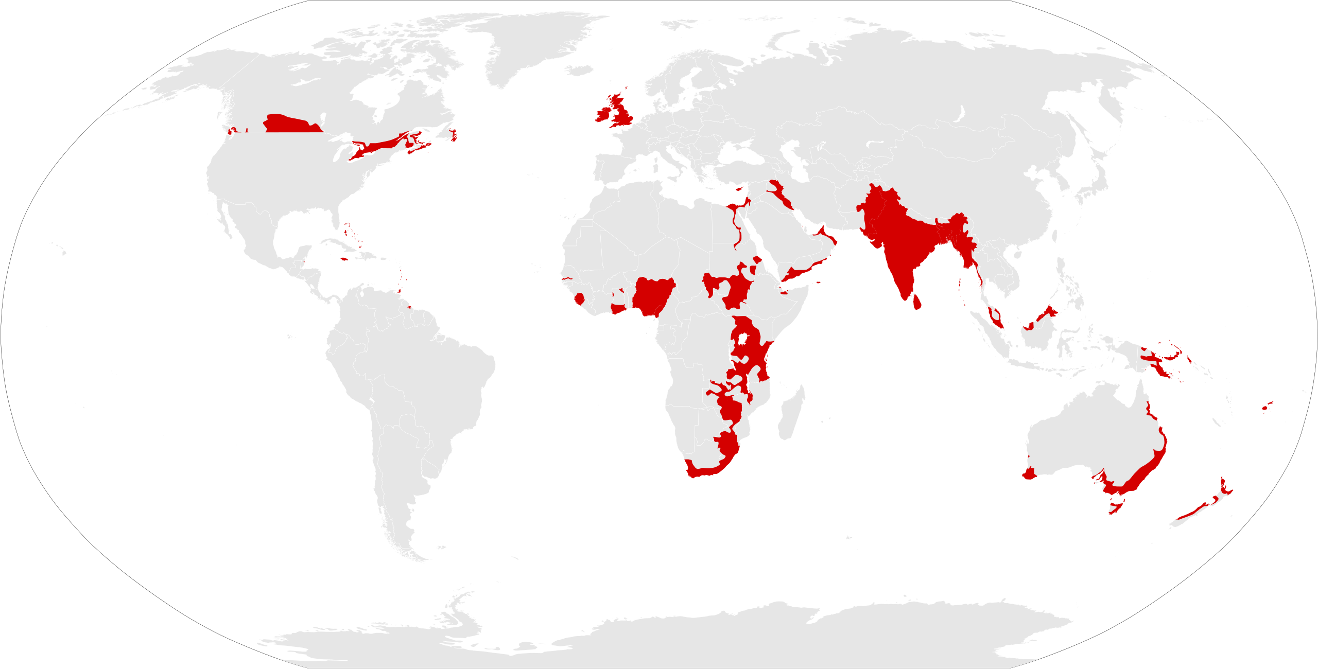
English: Populated areas of the British Empire (density >1 per square mile), c.1918
Sources: World Map Density of Population, 1918, The New Oxford Wall Maps of Australia, The Atlas of Canada, modern population density maps. |
| Date | |
| Source | Own work |
| Author | Nagihuin |
Licensing
I, the copyright holder of this work, hereby publish it under the following license:
This file is licensed under the Creative Commons Attribution-Share Alike 4.0 International license.
- You are free:
- to share – to copy, distribute and transmit the work
- to remix – to adapt the work
- Under the following conditions:
- attribution – You must give appropriate credit, provide a link to the license, and indicate if changes were made. You may do so in any reasonable manner, but not in any way that suggests the licensor endorses you or your use.
- share alike – If you remix, transform, or build upon the material, you must distribute your contributions under the same or compatible license as the original.
File history
Click on a date/time to view the file as it appeared at that time.
| Date/Time | Thumbnail | Dimensions | User | Comment | |
|---|---|---|---|---|---|
| current | 11:20, 27 July 2021 | | 2,754 × 1,398 (1.49 MB) | imagescommonswiki>Nagihuin | Uploaded own work with UploadWizard |
File usage
The following file is a duplicate of this file (more details):
.svg)
- File:British Empire (populated areas).svg from Wikimedia Commons
The following page uses this file:
.svg)